Sunday, November 18, 2007

The End?

I’m writing this on the last day of my trip as I speed towards Tokyo on the Shinkansen, which is perhaps my favorite train in the world. I’ve spent the better part of the last 300 days traveling from Sydney to Tokyo, a total of ten countries and dozens of cities, posting more than 100 blog entries and 3,000 photographs. That I'm going home hasn’t completely sunk in. I’ve been taking this trip one day, one week, one city at a time, and the end has crept up on me. So it is with mixed feelings that I return to Tokyo, where I’ll spend one more night before boarding a trans-Pacific flight (my least favorite form of travel) back to the U.S. of A.

I’m excited to return to familiar territory, where I speak the language and I am well versed in the customs. I’m looking forward to seeing family and friends, to eat my mother’s cooking and watch late-night cable television. But I’ll miss the freedom of the open road, the expected pleasures and unexpected impediments that make for open-ended travel. I’ve got an itch (no, not that kind of itch), formed early in life, that leaves me restless. It will lead to more travel in the future. For now, it's time to reflect on 2007 and look to 2008.

As a final installment of Packmonkey: Asia (leaving the door open to Packmonkey: North America and Packmonkey: Europe), I offer a short summary of the good, the bad and the in-between. This is hardly a recap of my entire ten months on the road, merely a short trip down memory lane. I plan to offer a little more reminiscing once I'm back in Los Angeles.


Everything Australian: I spent nine weeks in Australia in February and March, traveling overland along the southern and western coasts from Sydney to Broome, then into the Outback on a 4WD trek from Adelaide to Alice Springs. Australia is a beautiful country. The interior is desolate, stark and remote, the coasts rugged and wild. As a whole, it is a challenging, rewarding and breathtaking place to travel. I will never forget sleeping under the stars in the Painted Desert or swimming in sea lions in the Eyre Peninsula. I also made some lasting friendships in Oz: Bernie and Kate, Dean, Elizabeth – keep in touch! Australia raised the bar for all subsequent destinations. The time I spent in Australia amounted to the trip of a lifetime. Had I returned home after the Outback, I would have been satisfied.

Monkeys and Mountains in Malaysian Borneo: I arrived in Malaysia with low expectations. I left in love with the country. The Malaysian people were some of the friendliest I encountered - always a smile for the wandering Jew in their midst - and the food unexpectedly satisfying. The three weeks I spent in Malaysian Borneo sealed the deal: encounters with the orangutans, proboscis and langur monkeys, Uncle Tan’s jungle camp and the trek to the summit of Mt. Kinabalu, which left me exhausted but marked two of the best days of the whole year.

Backpackers’ Laos: Backpackers flock to Southeast Asia, so it’s no surprise that there’s a backpacking culture in this part of the world. My time in Laos, from my arrival at the border with Thailand to my departure from Vientiane, was the ultimate backpacker’s experience. The country itself is wonderful, remote and rural, yet unspoiled by the tourism you encounter in Thailand and Vietnam or the tragic history of Cambodia. Laos had been described to me as Thailand of 20 or 30 years ago. Ten short days in country showed me the Southeast Asia I dreamed of visiting.

What made my time in Laos really special was the friendships I made. Two days floating down the Mekong solidified a bond with my French amis, Guillaume and Emmanuelle. We spent the evenings in Luang Prebang at a sidewalk bar laughing over glasses of cloudy pastis, the days meeting the young monks at the city’s temples or swimming at the tranquil waterfalls outside of town. In Vang Vieng I met Mitzi and her daughter, Miksa, from Hawaii. We explored caves and rented bicycles for a trip to the local market. At night we relaxed over cheap food and beer at the backpacker cafes. Miksa and I even found time for a marathon afternoon watching "The Simpsons." Traveling friendships are short and intense, and one of the joys of travel.

Food, Food, Food: Who doesn’t love to eat? Everywhere I traveled there was something new to taste: kangaroo sausages in Outback Australia, blue rice in Malayasia, chicken rice in Singapore, khao soy in Northern Thailand, even deep-fried tarantulas in Cambodia. There were also some old favorites to devour: sushi and ramen in Toyko, curry and pad thai in Thailand. Somehow, I still haven't tried durian.

Indonesia Headaches: I arrived in Indonesia with high hopes. Two weeks later I couldn’t leave get out the country fast enough. From the touts and taxi drivers oozing desperation in Bali to the scam artists in Java who took me for a ride, I was overwhelmed by the amount of ill-will I felt in Indonesia. I’ve heard reports from other travelers about good times in Bali and Java, so I will not say the country is filled with bad people and bad times. At least I left with two good memories: sunrise at Mr. Bromo and an afternoon spent wandering the ancient Buddhist temple at Borobudur. These two places almost make up for all the aggravation I experienced everywhere else in Indonesia.

Tourism in Thailand and Vietnam: Thailand and Vietnam are two of the most popular destinations in Southeast Asia. They were also, for me, two of the most disappointing destinations on my trip. In the island of Southern Thailand, I encountered hoards of westerners traveling from one beach to another. It seemed that the locals in sight were either serving the foreigners beer and food or cleaning their rooms. There was also the terror of the night of the flying termites. The beaches are nice enough, but crowded and dirty. Were it not for the energy of Bangkok or the charm of Chiang Mai, I’d have to write off Thailand as a loss.

In Vietnam, the tourism treadmill also operates at full speed. Perhaps it was because I’d been on the road for six months, or perhaps it was because I was exhausted from a whirlwind tour of Cambodia. Whatever it was, I found Vietnam to be hectic in all the wrong ways. From the overcrowded and polluted streets of Ho Chi Minh City and Hanoi, where even the act of crossing the street was hazardous, to the constant haggling over prices, Vietnam was a downer.

Life and Death in Cambodia: I only spent 10 days in Cambodia, but those days contained some of the best and worst times of my trip. On the positive side was an extraordinary tour that took me into the Cambodian countryside and introduced me to the real Cambodia of today. The tour also resulted in a few of those backpackers’ friendships that I mentioned earlier. I loved drinking late into the night at a small bar in Kampong Cham and on the beach at Sihanoukville with Sally and Renee, nurses from Adelaide, Australia. And Kathe, a university student from Holland, turned into a close and unexpected friend.

On the down side was a bus accident that left two Cambodians dead and exposed the utter corruption and poverty of Cambodian society. I refer you to the impassioned blog post I wrote on the afternoon of the accident.

Return to Tokyo: I knew that I wanted to end my trip in Japan, to return to a place I lived for 18 months in the early 1990s. I did just that and I am now reminded of that old adage about not being able to go home again. In the years since I lived in Tokyo, I’ve changed, Japan has changed and the world has changed. I love the country and the Japanese. I loved taking Japanese lessons and exploring the country again. But in the end I could have done with less. I’d been on the road for most of the year and was tired, wanted to do little more than curl up with a good book and a glass of whiskey. So I spent most of my time in Tokyo enjoying solitude and rest.

My time in Tokyo was good for the spirit, but perhaps something of a missed opportunity. Perhaps what it taught me is that the next time I take off and travel the world, I’ll impose a six-month limit. For me, that seems just right.

So on the eve of my return to the U.S., I look forward to reuniting with family and friends, to starting a new chapter in my life that builds on everything that’s come before.

Some people say travel changes you. I think that’s a big fat myth. I’m still the same person I was when I started this trip. What I have now that I didn’t have before is a greater understanding of the world and my place in it. I think I’m more humble. I’m definitely more aware of how fortunate I am. My place in this world is small, but my future is unlimited. The end? I don't think so. Just another beginning.

A HUGE thanks to everyone who checked in and supported me over the past ten months. I will see you all very soon!
Labels: , , , , , , , , , , , , , , , ,

Thursday, July 12, 2007

Dunked!

The streets of central Chiang Mai are lined with guesthouses offering a repeating menu of adventure options. There are visits to hill tribes. There are classes in cooking, language, massage, dressmaking and more that I’m not aware of. The most popular activities, however, are those that guarantee the release of high levels of adrenaline into the bloodstream.

I’d spent a week in Bangkok and then a few days wandering around Chiang Mai, visiting temples, lounging in the coffee shops, browsing in the excellent used bookstores, and eating an astonishing variety of food, from the local specialty, khao soy, to organic beet and spinach salads to surprisingly tasty and authentic Mexican food. One definition of surreal is sitting at a sidewalk table in Northern Thailand, watching the tuk-tuks roll by while washing down a spicy carnitas burrito with a cold Singha beer (I would have preferred a Corona, but what can you do?).

Pork Burrito at Miguel's California Cafe, Chiang Mai

I'm sorry. I've been sidetracked by a burrito. Back to Thailand.

I was enjoying myself in Chiang Mai, but faced with so many sporting options I decided to spend my last few days in Thailand in pursuit of adventure. I’d been hanging out at a place called the Kona Café, owned and operated by Jason, an ex-pat American whose main business venture, Siam River Adventures, is taking tourists climbing, mountain biking, trekking and whitewater rafting. We sat down and hammered out a custom trip in which I would spend one day trekking (including a visit to a hill tribe), sleep overnight at the company’s camp on the Mae Taeng River, then raft down the river the next day. Jason would then drop me off at a bus station where I would catch a ride north that would take me closer to the border with Laos.

The trek was exactly what you’d expect in the forests of Thailand in the first week of July: hot, humid, sweaty and steep. Three hikers – a Canadian couple, Mike and Maureen, in the Thailand for two weeks of business and pleasure, and myself – were guided by a young Thai man, Singh, along a track used by elephants and then up a steep ridge to a Lahu village. Singh stopped at one point when he spied a patch of wild mushrooms off the trail. He later found another patch in a field of mountain rice and ended up with about two pounds of fresh mushrooms. “These mushrooms are very expensive in Chiang Mai,” he explained.

Trekking in Northern Thailand


Singh Picking Mushrooms

The Lahu village was a collection of rickety huts and a lot of dirty children. I realize I sound insensitive with this description, but that’s what I saw. These are poor people living in a mountain village. They receive hundreds of foreign visitors a month and out appearance barely registered on their consciousness. The kids were still very cute.

The villagers had slaughtered a pig that morning in celebration something that was never clearly explained to us (an Animist ritual of some kind, or a New Year’s celebration, take your pick), and served us fresh pork soup (heavy on the grease) and a local dish that was described as “raw pork” but I suspect is a dish made from the pig’s blood. If there’s one thing I will pass up anywhere in the world, from a village in Northern Thailand to the finest restaurants in New York City, it’s raw pork.

Communal Meal at Lahu Village


Mmmm... Raw Pork

The next day I met a group of tourists at the Siam River Tours camp and prepared for a few hours of whitewater rafting. I had rafted once in my life, on a family vacation when in Northern California. I recall placid stretches of water and occasional whitewater thrills. No one got too wet and no one fell out of the boat. The worst thing that happened was the boat carrying my mother (Hi Mom!) became stuck on the side of a large rock; the look of terror on her face remains in my memory to this day.

Back on the Mae Taeng, the ten rafters donned lifejackets and helmets and were given a safety briefing by the staff. I asked whether I should bring sunglasses or a hat and was told not to bring anything that I wasn’t willing to lose. I think I’d been assuming the river experience would be similar to the ride of my childhood. I decided to forgo sunglasses and hat and climbed into the boat.

On the second set of rapids the boat tipped and I tumbled into the drink. It’s every rafters fear, and when it happens it is so fast there’s little time to think. I was on the boat one moment and the next tumbling in a froth of whitewater. My hand went to my face, and I discovered that I’d lost my glasses. I then broke the surface and gasped for breath. It was that feeling you get when the wind’s been knocked out of you, when it’s difficult to get air and you don’t know if your lungs will ever fill with air again.

So here I am, half blind, gasping for oxygen, and being carried like a log down the muddy Mae Taeng River. But I didn’t panic. I was getting some air and realized it would only get easier. My lifejacket was keeping me afloat and nothing hurt. I remembered the safety briefing and pointing my feet downstream. I then realized I was somehow still holding my paddle as well as a shoe belonging to a fellow rafter who’d also fallen in.

In fairness to Jason and Siam River Adventures, the rafts were accompanied by three staff members in kayaks, all of them trained in water rescue and first aid. In addition to the kayakers, other staff members would stand on the bank of the river with throw ropes in hand in case someone need assistance. I never felt like the company hadn't taken every precaution available.

Over the next two hours we covered some Class 4 rapids, dropping into swirling pools and bouncing off the many boulders in the river. This was nothing like the trip my family had taken. This was serious rafting, treacherous, exhilarating and everything adventure travel should be. I was upset about the loss of my glasses, but to tell the truth, they were quite scratched up and had been bothering my for the past few weeks anyway. I am now wearing my backup pair and am happy to have clear lenses again.

Labels: , ,

Thursday, June 07, 2007

Rocky Mountain High

I’ve been to desert, ocean, city and swamp. I’ve swum with sharks and sea lions, encountered deadly snakes and wrangled with disingenuous locals. I’ve climbed a bridge, visited temples and photographed skyscrapers. I’ve downed delicious tropical juices and devoured mounds of Chicken Rice. What’s a traveler to do next? How about climbing a mountain?

Mount Kinabalu in Malaysian Borneo is thee tallest mountain between the Himalayas and Papua New Guinea. At 4,095 meters (13,435 feet), Kinabalu can’t compete with the world’s great peaks. It’s not even half as tall as the five highest peaks on the planet. Kinabalu doesn’t even rank in the top 100. It’s a runt in a land of giants. But I’m a hiker, not a climber, and 13,435 feet is a noble challenge.

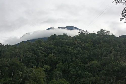
Mount Kinabalu Obscured by Clouds
(As Seen From Kinabalu National Park Headquarters)


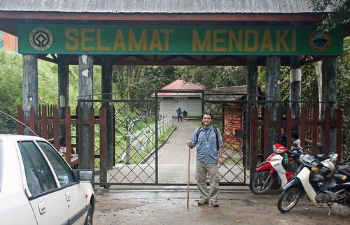
"Selamat Mendaki" (Happy Mountaineering)

The trek takes two full days. I would stay in a hostel in Kinabalu National Park, at 1,564 meters (about 6,000 feet), then wake early for a day of hiking from Timpohon Gate to the resthouse at Laban Rata, a distance of six kilometers and 5,000 vertical feet. I would then spend the night in a hut at 11,000 feet, waking up at 2 a.m. to tackle the summit, a climb of 2.7 kilometers and an additional 2,500 feet of elevation. Numbers are all well and good, but don’t tell the whole story.

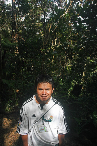
Everyone who climbs Mount Kinabalu must hire a guide. My guide was Julius, a deceptively reserved local who has spent his entire life within ten kilometers of Mount Kinabalu. He started working as a porter when he was 14. Now, at 28, he doesn’t know how many times he’s climbed to the summit. He does, however, estimate that he could make the 18-kilometer round-trip in about five hours. Life all the porters and guides I encountered on the mountain, Julius was strong as an ox and modest as a wallflower.

Julius was an excellent guide and climbing partner, never pushing me to go beyond my own pace, and happy to point out flora that I would otherwise have missed, like the carnivorous pitcher plants that trap their prey in a cup of sticky syrup. He was also good for conversation, delivering a string of out-of-left-field questions like “Do you know Chuck Norris?,” “Do you like women with big breasts?” and “Do you believe in black magic?” These moments of absurdity help me immensely and I thank Julius for his offhand take on the world. He was also my unofficial photographer, though he could use a lesson in composition and the importance of a level horizon.

Julius, Master of the Mountain


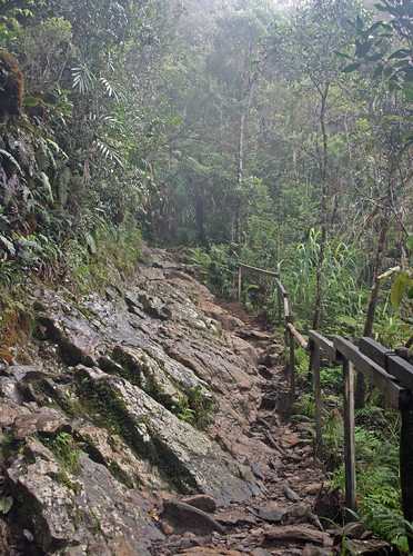
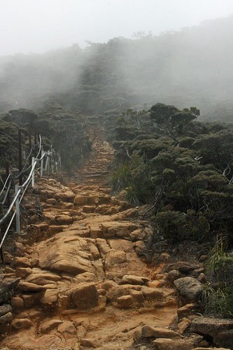
I’ve done my share of hiking, and wasn’t concerned about the climb itself. Other travelers said I’d be sore in the days to come, but that seemed par for the course. What I discovered soon after passing through Timpohon Gate, however, is that Mount Kinabalu is more climb than hike. There’s nothing subtle about the trail; it is rocky, steep and treacherous. Well maintained, yes, but challenging. About 20 meters out 8.7 kilometers is on level ground. The rest is incline, over rocks and roots, up steps, around boulders and across rock faces. The steps are tall, consistently up to my knee and sometimes up to my thigh. Even with the walking stick, I often struggled to find my footing and had to pay attention to every step.

The Summit Trail...


...It's a Walk in the Park

Within the first hour of the climb I started to feel fatigue. But Julius gently urged me forward, telling me, “You are a very strong man,” and I soon found a comfortable pace. We covered the six kilometers to Laban Rata in four hours and forty-five minutes, arriving at 1:30 in the afternoon. I was the fourth climber of the day to make it to the camp, and I entered the empty resthouse exhausted and happy. Still, I was unable to eat, unable to do anything but rest my head on a table and wish for unconsciousness. I checked in at registration and dragged myself another ten minutes up the trail to my hut, where I found a comfortable bunk and two warm blankets.

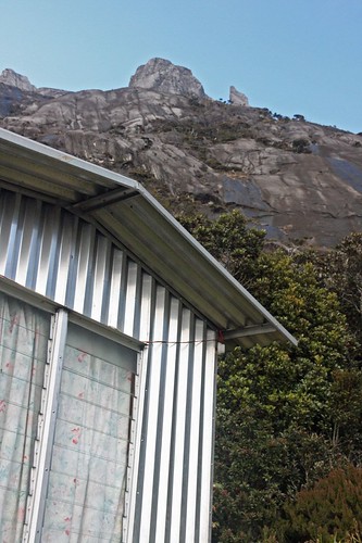
Panar Laban Hut

I awoke three hours later feeling rested and alert, and returned to the resthouse for a meal. What had been an empty hall in the early afternoon was now crammed to the rafters with climbers. There was tempered excitement in the air. Everyone in the room had climbed up the mountain; we were equals in this endeavor whether the climb had taken four hours or fourteen (the average is about six hours). We were a collection of weary faces and slumped postures, but we were now some of the highest people in Southeast Asia.

I retired to my bunk at 7:30 an settled in for a few hours of sleep. Julius woke me at 2 a.m. After snatching a quick cup of weak coffee at the resthouse, I gathered my supplies (headlamp, gloves, hat, camera, energy snacks, multiple layers of clothing) and set out to conquer the summit.

Julius and I had hiked through rainforest most of the previous day, and had spent the night in an alpine zone of stunted trees and sparse shrubbery. Now we would cross the timberline and hike cross a great slopes of bare granite. The air was thin, but at least the terrain was fairly even.

We set out at 2:40 and within a few minutes passed a young woman vomiting by the side of the trail, a visceral reminder of the situation. Anyone can climb Mount Kinabalu – it doesn’t require mountaineering skills and can be accomplished in a sturdy pair of walking shoes. The climb is, however, very strenuous and without a moderate level of physical fitness you will suffer. And there’s the unpredictability of altitude sickness –even the strongest of athletes can be hobbled by elevation.

I was aware of the altitude, and decided to take my time. If it took five hours to hike 2.7 kilometers, so be it. As I trudged up the mountain, my progress slowing as I gained more elevation, I thought of every National Geographic special I’d seen about Everest, recalling how climbers would take one step, then rest, another step and another rest. And here I was crossing 12,000 feet, taking a few steps at a time, and resting. I was walking slow, slower than I’d ever walked in my life, slower than a tourist on Seventh Avenue or rush hour traffic on Santa Monica Boulevard.

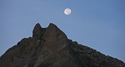
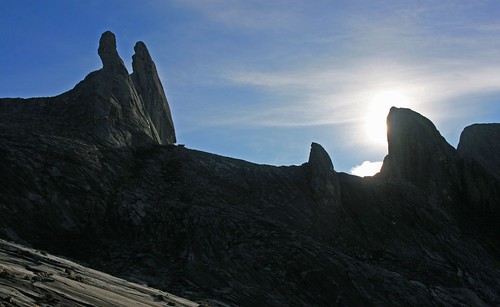
I pushed on, following the thick white rope that guides climbers up the naked rock to the summit. The full moon had passed a night or two earlier, and I was able to turn off my headlamp and hike by moonlight. Jagged peaks were outlined against the starry sky. Perhaps it was the exhaustion, or the realization that willpower was propelling me closer and closer to my goal. Perhaps it was the elevation. Whatever it was, I couldn’t think about reaching the top without experiencing an upswell of emotion, tears of joy threatening to erupt at any moment. But I kept my emotions in check and set my sights on the only thing that mattered: the summit.

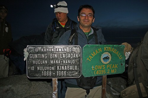
Low's Peak (4,095 Meters)

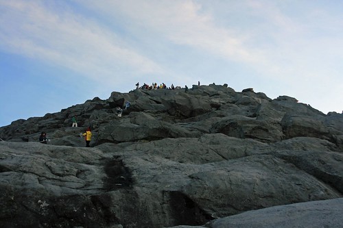
My legs felt great, but I was acutely aware of my lungs and my heart rate. Passing 13,000 feet, I’d push myself 10 or 20 feet and have to stop, gasp for a few breaths while my heart thudded in my chest. It took me an hour to cover the last 500 meters. I covered the final 100 meters at a slow crawl, using hands and feet to clear the jumble of boulders below the summit.

Meanwhile, Julius was like a kid at the playground, jogging up and down the slope behind me and bouncing up and down for warmth. I should have hated him, but was inspired by his enthusiasm. Even after 14 years and countless ascents, he displayed an impish glee at being at the top of the mountain. I’m sure Julius earns a paltry salary for his efforts; he deserves much, much more.

There’s an old saying that the journey is the reward, not the destination. I reached the summit, asked an older Japanese man to take a few pictures of me and was quickly ready to start climbing down. The sun was about to break the horizon, and there were dozens of climbers clamoring for space on the narrow summit. Also, I felt a sudden surge of nausea and didn’t want to vomit on the expanse of Southeast Asia that lay below me.

The Summit

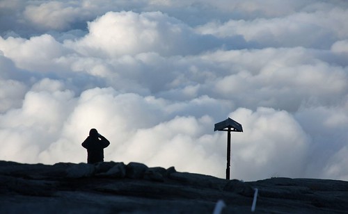
With the rising sun illuminating the slopes, I took my time on the descent, photographing the peaks that were only outlines an hour before. A cottony layer of cloud covered the land, perhaps a thousand feet below me. I realized that no birds were singing, no frogs croaking, that plant life was stunted and wispy, clinging to the crevices in the rock. I was tired, so tired, but still in awe of the scenery, appreciating every moment I had earned with hard work and perseverance. I was reminded of my love for the Australian Outback and the American Southwest, for the harsh spaces where only the hardiest of species survive. Beaches and forests are great, but for me there’s real beauty in the barren. I wonder where that comes from?

Moon Over Kinabalu


View From the Top


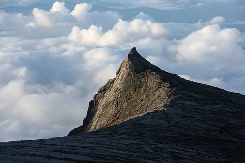
South Peak


Sunrise Over Kinabalu


Two hours later I was back at Laban Rata, eating a breakfast of ramen noodles and ready to complete this adventure. But Kinabalu National Park had one more surprise in store for me. The park is in a rainforest. I had been lucky the previous day and climbed without encountering one raindrop. On the descent, however, the rain never let up. It never poured, just a steady mist and drizzle that increased the difficulty of the trek. All those steep slopes, the rocks and roots were now wet and slippery.

On the hike down, we encountered the next day’s climbers making the ascent. I urged them on with words of encouragement, telling them the summit was worth the effort. Around kilometer two an elderly Australian man asked me if the climb got any easier. I should have said it was a piece of cake, but told him the truth, that no, it really doesn’t get any easier, that it’s a slog from start to finish, both going up and coming down. He seemed put off by my answer, but asked me if I’d do it again. Without hesitation, I said “Yes.”

I surprised myself with this quick response. Mount Kinabalu was the toughest climb of my life, a challenge for mind, body and spirit. I loved every terrible minute.

Mission Accomplished!

Labels: , , ,

Tuesday, April 03, 2007

Heading Bush

No journey Down Under would be complete without a visit to Uluru, the giant rock in the center of the country. I saved Uluru for the end of my trip because to go in February or early March would have meant facing temperatures over 100 degrees in the shade. Despite everything I’ve done in Oz, it turns out I saved the best for last.

I have been taking a lot of photos on this trip, and getting back to photography has been an unexpected delight. I studied a bit in high school, but dropped it as a hobby for many years. However, the advent of digital photography has changed everything. No film, no fuss, no muss. I can now take as many photos as a memory card will hold, then later use my computer and Photoshop as a digital darkroom.

If you are wondering why there are so many pictures from the Outback, it’s because I decided to treat myself to a new camera. My Canon Powershot 400 was fine for snapshots but didn’t give me the control I wanted. If you notice any improvement, give some credit to the equipment: a Canon Eos 400D Digital SLR with an 18-200mm Sigma lens. I ended up taking over 1000 photos on the ten-day trip through the Outback, and more when I arrived in Alice Springs. I’ve posted 341 on Flickr for all to see. Comments are encouraged.
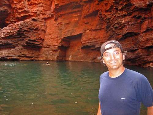
After three bus tours, I decided to splash out on a 4WD camping expedition with a company called Heading Bush. The brochure describes the trip as an “Outback Experience.” The journey would cover about 3,000 kilometers between Adelaide in South Australia and Alice Springs in the Northern, mostly over dirt tracks. Every night would be spent camping in swags. We were forced to take shelter for two nights in tents –at a campground infested with mosquitoes and during a desert rainstorm – but most nights were spent under the stars. Chalk it up as another “Outback Experience.”


Armed with a new camera, and a fresh haircut (take note, Michael Park), I was ready for the Outback. I was picked up at my Adelaide hostel well before sunrise on March 22 by Simon, veteran guide, Outback mechanic, bush chef, ice coffee devotee, and endearingly eccentric character. Imagine Bruce Dern in crazy mode and you’ve got the picture. Simon was the best guide I had in Australia. He was professional, friendly and knowledgeable. In ten days he was never unable to answer a question I threw at him, and I threw him some pretty obscure questions about flora and fauna, Australian history and the minutiae of geology. His only fault is his cigarette addiction, but even that didn’t get in the way of a good time.

Because we were traveling in a truck, space was limited to ten passengers – two in the front with Simon and eight in the back arranged on two benches facing each other. With the possibility of a cramped and uncomfortable journey, I was relieved to find my fellow passengers were normal sized Europeans, not large and in charge Americans.

Joining me at the hostel was Marcella, a depressive Italian in her mid-40’s with limited English and even more limited interest in life. She checked out mentally and physically after the first day and spent most of the time moping behind black Ray Bans, either in the back of the truck or asleep in the campground. We found out that she didn’t know the tour was a camping expedition before it started. Who signs up for a ten-day trip without reading the brochure? But that was Marcella’s trip and I was determined to enjoy myself regardless of her precarious mental state.

The company improved immediately with Annick and Juliette, friends from Holland who I’d traveled with in Western Australia. By the time we got to Alice Springs on March 31, we’d spent nearly three weeks, 24 hours a day together with only brief moments of annoyance. More twenty-somethings arrived in a Swiss contingent: Sonja and Marion, who met while studying English in Sydney and were a few weeks into a three-month tour of the country. Three lone travelers from Germany, all women, Kirstin, Verena and Antje, joined next. Strangers to each other when they began the trip, they were kind enough to avoid speaking German most of the time. At this point I was getting nervous that I’d be the only man on the trip. But then we picked up another bloke, Dean, a fine fellow from Dublin who, like me, had quit his job (with ExxonMobile – boo!) to travel. I’d love to be surrounded by women for ten days but a guy needs a pal to drink with after long days in the desert.
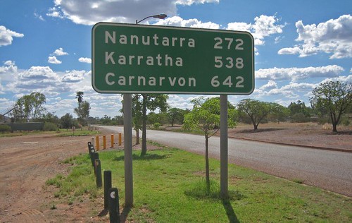


I will spare you another blow-by-blow account and concentrate instead on a couple of highlights.

To give you a sense of the breadth of the journey, however, here is the itinerary (links point to photos on Flickr):

Day 1

Pick up in Adelaide
Lunch in Port Augusta
Southern Flinders Ranges – Aboriginal Art at the Yourambulla Caves
Bush Camp at a Sheep Station at Arkaba

Day 2

Bushwalk at Wilpena Pound
Overnight at Iga Warta (“Home of the Native Orange”), an Aboriginal Community

Day 3

Morning at Iga Warta – visit to an Ocher Pit
Crazy Desert Artist Outside Lyndehurst
Lunch at Marree on the Old Ghan Line
Mutonia Sculpture Park
Lake Eyre South
Oodnadatta Track
William Creek Hotel
Bush Camp outside William Creek

Day 4

Lake Cadibarrawarricanna (“stars twinkling on the surface of the water”) – the longest place name in Australia
Dog Fence
Opal Mines at Coober Pedy
Bushcamp in the Painted Desert

Day 5

Painted Desert morning walk
Hookeys Waterhole and the Coolabah tree
Oodnadatta – Pink Roadhouse and an Aboriginal School
Fogarty’s Claypan
Pedrika – Old Ghan Station in ruins
Dalhousie Ruins
Camping at Dalhousie Spring

Day 6

Sunrise at Dalhousie Spring

Milkshakes at the Mt. Dare Hotel
Finke River Road – oldest river in the world
Bloodwood tree
Lambert Centre – the geographical center of Australia
Kulgera Roadhouse
Bushcamp in the rain outside of Uluru Kata-Tjuta National Park

Day 7

Curtin Springs – breakfast with a scowl
Camp at Ayers Rock Resort

Day 8

Uluru Base Walk
Uluru Sunset

Day 9

Uluru Sunrise
Bushwalk through the Olgas
Bushcamp outside Kings Canyon

Day 10

Bushwalk through Kings Canyon
Drive to Alice Springs

The star of the tour was Uluru, and Uluru did not disappoint. Anyone who flies to the rock then flies out again is missing half the experience. Here is a giant rock in the center of a vast, empty desert. To add to the strangeness, Uluru is like an iceberg, with only about a sixth of its mass above ground. It is a spectacle no matter how you get there. For me, the jouirney was part of the experience, and without the days spent crossing the desert I wouldn’t appreciate how special this mass of stone really is. It shouldn’t be there, but it is. Also, I took many pictures (too many, you will say once you check out Flickr), and they are pretty, but nothing can compare to standing next to Uluru. Like the Pyramids in Egypt or the Grand Canyon, you have to see it for yourself.


While Uluru is famous and gets all the attention, it was the days we spent far from civilization and the quiet, lonely night under the desert sky that I will remember most. As I mentioned, we were traveling, for most of the trip, on dirt tracks. There is very little traffic and sometimes we would rarely see other vehicles. When camping in the Flinders Ranges and the Painted Desert, there was no around for miles. When we slept in the Painted Desert, we spent the whole evening, all night and all of the next morning without seeing anyone else – just us, the kangaroos, snakes and a million stars in the sky. It was the best night of sleep I’ve had in years.


There are more stories to tell about the Outback and Australia. I’m spending this week in Darwin, on the north coast of Australia, preparing for Bali and Southeast Asia and looking back on the wonderful two months I’ve spent in Oz. I’m not ready to leave.

I bought unlimited Internet access for the week (and paid too much, again), so I’ll be writing short posts about the Outback and my time in Australia, like the story of Dean’s Ear, the Tale of Matt’s Hat, and the battle for the best Potato Chip (crisp, if you must), in Oz.

If there’s anything you want to know, drop me a line. For now, enjoy the pictures (especially you folks who are in them – you made great subjects!). I know there are a lot, but sometimes too much of something is just enough.

Labels: , , ,

Tuesday, March 20, 2007

On the Road in WA

Having spent a week in Perth I was ready to get on the road again. This time, I’d signed up with a company called Western Xposure for a nine-day trip up the west coast, with stops at two places on the beach and a few days in stunning Karijini National Park. The bus picked me up from my hostel at 7 a.m., then stopped at the bus station to load the rest of the passengers. A diverse group included two Americans, me and Tim, a beer-brewing resident of a remote Alaskan island; one Canadian; four Japanese, including Rina, a who was in Australia to improve her English; a Brazilian; and the usual assortment of Europeans, favorite, Liz from England, the Dutch friends Annick and Juliet, and characters from Italy, Portugal and Germany. Ages ranged from 20 to 54, and as we got to know each other it felt like the mix of personalities would bode well for a fun trip.

Our driver/guide was Dan, from Perth, whose interests are limited to the outdoors and chasing women. He briefs us on the trip and then says there is some bad news. A few days before, a cyclone roared through the Pilbara region of Western Australia. Winds up to 275 kilometers an hour caused extensive damage and a few people were killed. It is front-page news in WA. Dan tells us Karijini is closed to all traffic as the situation is sorted out. If we cannot make it through to Broome, we will be forced to turn around and head back to Perth. I fret for a few minutes then decide to worry about it in a few days. We will make it to Broome, but the cyclone will affect the trip in a big way.

Perth to Kalbarri (March 10, 2007)

Western Australia is the country’s largest state, with about 2 million people. About 73 percent live in Perth, in the southwest. In the country as a whole, there is an average of 2.7 people per square kilometer. In Western Australia, that figure drops to less than 1.

Having traveled more than 7,000 kilometers over land from Sydney to Perth, I appreciate that the country is both vast and empty. Any trip from one place to another covers large stretches of unremarkable scrub and open sky. Miles and miles of highway offer little more than a steady view of flat, open country.

When there is something the break up the landscape (and the monotony), it is most often an unusual natural phenomenon. The Pinnacles in Nambung National Park, 245 kilometers north of Perth, is one natural wonder, and the first stop on the tour.

The park is on the Swan Coastal Plain, an area of shifting yellow sands and coastal heathlands. Out of the yellow sand rise thousand of limestone pillars, a handful more than ten feet tall but most just stumps. Taken alone, each pillar is forgettable. As part of a larger landscape, the Pinnacles are otherworldly, another enigma to marvel over.


The pillars were formed millions of years ago when seashells broke down and were carried inland by the wind. They compacted into limestone and over the years were covered by sand. The dunes stabilized when vegetation took hold, leading to a layer of acidic soil developing over the soft sand below. Over time a hard layer of calcrete formed over the limestone. When plant roots cracked through the calcrete layer, water seeped into the earth and eroded the limestone. What remains today are those areas of limestone that were resistant to erosion (however, they are still eroding today – nothing lasts forever). When winds carried the dunes away, the limestone pillars were exposed.

The Pinnacles reminded me of a site in the Southwest of the United States called Goblin Valley, where toadstool sandstone formations rise from the desert floor. The site was used to excellent effect in the sci-fi farce “Galaxy Quest.”

After the Pinnacles it was a short drive to a series of white sand dunes for some sandboarding. It’s like snowboarding, only slower and you can’t turn. The instructions were to point the board down the dune and hope you don’t fall. The lesson of sandboarding: you are guaranteed to end up with sand in every crevice of your body. Laughing with your fellow travelers as others wipe out at the bottom of the dune is also a great way for the group to get to know one another.

Kalbarri to Monkey Mia (March 11, 2007)

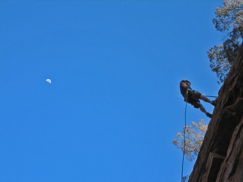
Murchison Gorge in Kalbarri National Park is a preview of what’s to come later in Karijini National Park, a few thousand kilometers north. A river cuts through deep red sandstone to create a scenic gorge. A short hike brings us to a sheer 25-meter cliff, where I take the opportunity to abseil (when did rappelling become abseiling?). I make two trips, first like a normal person with my legs below me, then a gut-busting abseil face down the cliff. I was the first to take the plunge headfirst and am happy to receive a round of applause at the bottom.


A long afternoon of driving and we arrive at Shark Bay, one of 14 World Heritage sites in Australia. The area consists of two small peninsulas that jut into the Indian Ocean. One of these, Peron Peninsula, is the site of Project Eden, a government-sponsored effort to reestablish native wildlife into the peninsula. To do this requires ridding the area of all introduced species – cats, rabbits foxes, goats – and reintroducing native species. To keep the feral beasts out of the area, the government has erected a vermin fence spanning the 4-kilometer entrance to the peninsula. There is a road that the fence cannot cross, but there is a unique solution. Any creature that comes near the fence is greeted by a recording of barking dogs and truck horns.

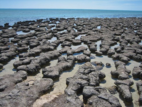
Shark Bay also features a natural wonder that is one of the reasons I came to Western Australia. I learned about stromatolites when I read Bill Bryson’s travelogue about Australia, which is called “Down Under” in the U.K. and Australia and "In a Sunburned Country" in the U.S. The single-celled creatures were the first living organisms to emerge on the planet. Stromatolite fossils have been dated to 4.5 billion years ago, and were the only form of life on the planet for nearly 2 billion years. They gave rise to other single-celled creatures, then multi-celled organisms. The rest is biological history. They are a testament to evolution and, amazingly, there are a few colonies that survive today.


However, stromatolites are not much to look at, merely black rocks in a tidal pool. But with a little backstory, they are fascinating. At least I thought so. Others in the group seemed ready to go after a few minutes.

Monkey Mia to Exmouth (March 12-14, 2007)


The coastal resorts of Monkey Mia and Coral Bay and the town of Exmouth are the main attractions in this part of Western Australia.

Monkey Mia is a resort village best known for the dolphins that show up like clockwork every morning. Tourists gather on the shore for the show, receiving an instructional brief from a park ranger before taking part in a short feeding. The dolphins are wild and must fend for themselves the rest of the day. I think dolphins are interesting, and there was a calf in the group that made an appearance, but the spectacle of a hundred tourists gathered on the shore strikes me as easy entertainment for the masses. If I’d never seen a dolphin before I might have been entertained.

Also depressing was a stop at Ocean Park, a ramshackle, privately owned “aquarium” with a handful of small pools holding sharks and rays and tanks containing sea snakes, turtles and a few poisonous specimens. Ocean Park operates as both a marine rehabilitation facility and a tourist attraction. I don’t know how well they are doing as a rehabilitation facility; as a tourist attraction it was dismal. I was reminded of unscheduled stops in third world countries in which you can witness children making carpets. Nevertheless, seeing a deadly stone fish (you die from the pain, not the poison) and touching a sea snake was worth the $5 price of admission.

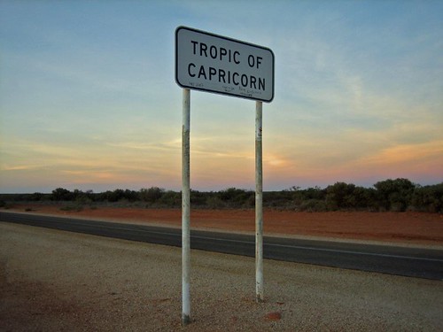
More than 400 kilometers north is Coral Bay. About 50 kilometers from the town, the highway crosses the Tropic of Capricorn. There is a sign and a white line painted on the road. After taking photos, we took turns writing our names on the line with a fat magic marker. I was not amused by Ocean Park, yet the stony stromatolites and a geographical marker in the middle of nowhere gave me great pleasure. What does that say about me? Comments?


Coral Bay is bigger than Monkey Mia. When I say bigger, understand that the population is only about 150. But Coral Bay is a gateway to the Ningaloo Reef, the largest west-coast reef in the world.

One of Australia’s most famous attractions if the Great Barrier Reef, on the east coast in Queensland. I’ve been told that Ningaloo Reef, which is protected within Ningaloo Marine Park, rivals the Great Barrier, but unlike the Great Barrier, which requires visitors to travel by boat to get to the reef, it’s only about 100 meters from the beach. Another big plus for Ningaloo is that it gets a small fraction of Great Barrier’s traffic.

On the morning of March 13, I sign up for a three-hour kayak/snorkeling tour. It’s a short paddle to a spot where sharks gather to clean their gills. Another short paddle takes us to a spot featuring the usual assortment of colorful coral and fish and we see a couple of sea turtles. The water is not as clear as it could be because the night before, the coral spawned. This annual event happens after the full moon in March, when the coral release sperm and eggs into the water. Best not to think about what you are swimming through.


The trip from Perth has included a few days of solid driving, and after kayaking it’s a relief to spend the rest of the afternoon lounging at the beach. The water is warm, the sand is white and the beach is beautiful. It seems like we spend more time floating in the shallows than sitting on the beach, playing like children on a summer’s day.

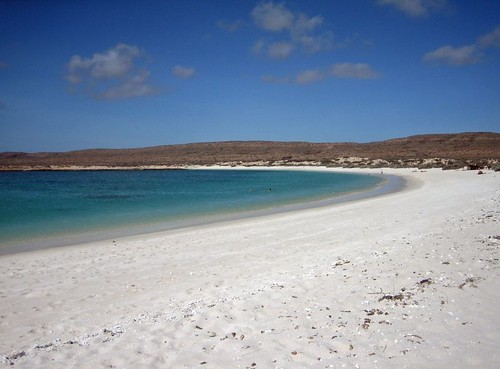
Another 200 kilometers north is the town of Exmouth (pronounced like it is spelled: Ex-Mouth), population 2,500. It is the base for the northern end of the Ningaloo Reef. Sixty kilometers further is Turquoise Bay, one of the best beaches I’ve been to in my life, maybe the best. If Coral Bay was beautiful, Turquoise Bay is exquisite. It’s hard to believe from the perfect conditions that a cyclone roared through the area a week before.

Turquoise Bay is the kind of place I came halfway across the world to experience: remote, relaxing, and extraordinarily beautiful with fun activities and very few people. It’s the kind of place that justifies all the planning, travel, time and money. Of all the beaches I’ve seen in Australia, Turquoise Bay is the one I want to return to the most.


After setting up shelter, about 15 of us gather for a drift snorkel. We walk down the beach, around a point and along a few hundred meters of the reef. There are strong currents and rip tides at Turquoise Bay, strong enough to sweep lazy or weak swimmers out to sea, permanently. And Dan makes sure we know if, saying, “If you don’t make it back to shore, you will be swept out there, and I won’t come after you.”
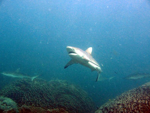
But if you exit the water before reaching the rip, there’s no problem. And since the current along the reef is so strong, you can let the water carry you over the reef, expending little energy other than pointing and oohing and aahing at the marine life below. On the first trip over the reef, as a group, there are no reef sharks or turtles. Later, in the afternoon, I go out again with a small group at high tide. We enter the water and bang, there’s a 4-foot black-tipped reef shark about ten feet in front of me.

The reef shark looks for an escape, gliding quickly left and right before darting off into the murk. But a minute later there’s another one. Or is it the same shark? Same coloration, same size. It swims away. Then a minute later there’s another. This time I’m convinced it’s one shark circling the area looking for food.

Since seeing “Jaws” as a child I’ve harbored an irrational fear of sharks. I previously wrote about swimming with dolphins in Victoria, where a “shark shield” was offered as protection against predators. While snorkeling in Coral Bay and today, there are no man-eaters, but I’m still nervous about swimming in open water with sharks. Once I see them up close, I realize most really are more afraid of me than I am of them. .

Karijini National Park (March 15-17, 2007)


We learn while in Exmouth that the roads to Broome are open and that Karijini National Park is scheduled to reopen by the time we arrive in the evening of March 15. We also learn that because of the cyclone, the tour that left before us was unable to continue to Broome and that there is no bus to take passengers back to Perth. This doesn’t affect me because I’m flying out of Broome, but causes some anxiety for others on the tour.

After all the complaining I did about being stuck in Perth, it ends up benefiting me. If I had joined the tour five days earlier I would not have been able to experience Karijini.

Saying goodbye to Ningaloo Reef, we are on the road most of the day, arriving at Karijini National Park in the late afternoon. The cyclone has fed the landscape, and the park is a riot of deep red rock and bright green scrub. After all the gray, green and white scrub on the coast, the colors are a magnificent treat. I can tell I am going to like this place and I’m haven't gotten off the bus yet.

When I booked the tour in Perth, my travel agent described Karijini as “Australia’s Best Kept Secret.” Our guide describes it the same way. I had also seen Karijini profiled in a few travel shows. The love comes from a series of gorges offering the chance to do a bit of canyoneering, a general term a mix of walking, swimming, rock climbing and abseiling through narrow canyons. The most famous hike, called Miracle Mile, is no longer open due to safety concerns, but we are told that we will enter a few of the gorges, some of them no more than 3 or 4 feet wide and a few hundred feet deep, for a taste of adventure.

Up to this point we’ve been sleeping in backpackers’ hostels. Tonight I will finally get the chance to sleep in a swag, which is basically a canvas bedroll with a mattress built in. You roll it out on the ground, put your sleeping bag inside, and sleep under the stars. I had not heard of a swag before arriving in Australia and was very excited about the night ahead.

Not everyone shared my enthusiasm and most spent the night crowded on a huge tarp next to the bus. I chose a spot about 100 feet away, as did three other campers. At about 3 in the morning, I was woken by a scream and saw Julie, a woman from France with little interest in camping, run by my swag. “There was a dog right next to me,” she shrieked. Then she blinded me with her flashlight and begged to know if it was really a dog and whether it was dangerous. I told her it was probably a dingo and that it would not eat her unless she was a kangaroo. Dingo sightings are rare, and the only person who saw it was the one least interested in the outdoors. Unfair. At least I got to see the poisonous red-backed spider that lives in the outhouse.

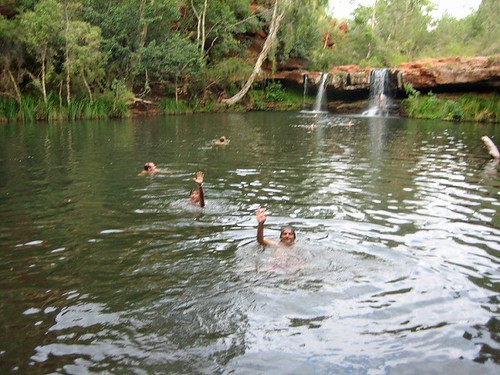
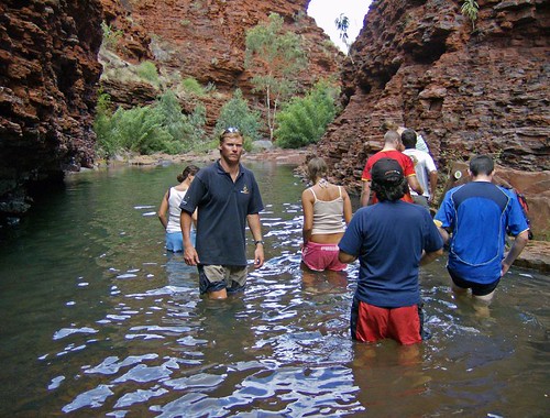
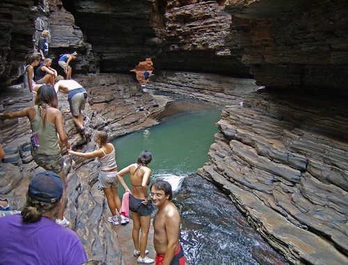
In Karijini over the next two days, we swam in freshwater pools, bathed under waterfalls, squeezed through narrow gorges and traversed rock walls above stony riverbeds. The gorges are imposing and the hiking treacherous. There are many fascinating geological specimens (rocks), including the oldest exposed rock on the planet (about 4.5 billion years old). There was only one minor injury (Marcus, from Germany, twisted his ankle on the first hike) and no one died, even though slipping and falling from any number of places would have resulted sever injury and possible death. When you are 30 feet above a canyon floor, inching along a narrow ledge, you can only think about not falling. I agree with the sentiment that Karijini is Australia’s best-kept secret. It is spectacular. When and how can I return?

One hike worth mentioning was on the morning of our first full day. We walked down a path to Fern Pool, a secluded waterhole with a pair of small waterfalls. After a short swim, we continued down to Fortescue Falls, where a small a trickle washed down the slanted rock. Further down the gorge, there was debris from the runoff after the cyclone, knotted trees and branches and flattened grass. As we approached a side channel to visit a place called Circular Pool, it started to rain, not hard, but enough to get us wet. We continued to the pool and the rain got heavier. A very quick look and we turned around and started hiking up a side trail back to the bus. As we ascended, the rain increased. By the time we reached the top, it was an absolute downpour.


I’m not keen on walking in the rain, but this was an exhilarating experience. In just a few minutes, dry canyon became line with waterfalls. The riverbed we had walked down was visibly higher and would have been impossible to walk along. The landscape changed within an hour from fairly dry to spectacularly wet. We returned by bus to Fortescue Falls, and what had been a trickle was now a torrent. The trail we had taken was completely underwater. I’ll take a soaking in Karijini any day.


Karijini to Broome (March 17-18, 2007)

Not everything goes according to plan on tour. We leave Karijini in the afternoon and set out for a sheep station where we will camp for the night. We will still be sleeping in swags, but we are promised hot showers and flush toilets. The stench in the bus tells me showers are an excellent idea for everyone.

We arrive at the sheep station, a 500,000 square kilometer private farm where there are camping facilities for tourists. We turn off the road and onto a dirt road, where Dan tells the group that we are crossing a dry river bed that becomes impassable maybe one a year when it floods. After about 200 meters, the bus gets bogged in deep sand and we are told to get out and push. No kidding. And we don’t even have to pay extra for the experience. We spend the next 30 minutes digging and pushing to free the bus. We make it across the dry river bed as the sun sets only to travel another 100 meters to discover a wide torrent of water blocking the road. It seems we’ve arrived at the rare time when the river is flowing.

The water is runoff from the cyclone the previous week. There is a truck on the other side of the river, about 100 meters away, and Dan sets off into the river armed with a shovel to test the depth and for stability. The water is never higher than his thigh, but still too high and fast for us to cross in the bus. And we learn when he returns that the cyclone has flattened all the facilities. The farmhouse is standing, but the campground and showers have been destroyed. There’s nothing for us to do but turn around and look for someplace to spend the night. We give ourselves a round of applause for making it out of the sheep station after two rough hours in the dark.

We head up the dark highway for 35 kilometers to a parking area that is nothing more than tarmac and a yellow rubbish bin. We pull in at about 10 p.m., park the bus and prepare dinner. There is nothing but the bus, we campers, tarmac, scrub, the occasional road train on the highway and a billion crickets, mosquitoes (mozzies) and other insects.

It is out last night of the tour and we’ve become a functional group, so we make the most of the situation, preparing dinner and drinking the last of the beer. When a brief spot of rain comes, we take shelter in the sweltering bus. But it passes and we continue our roadside party. There had been two birthdays during the tour and someone pulls out candles and sparklers. Desert, beer, fatigue and sparklers – who needs drugs for a surreal experience?

Bedtime approaches and we lay out our swags in line with the bus, just in case a road train stops during the night. There are still dark clouds in the sky and it looks like there will be no escape from the rain.

I sleep until about 3 a.m., when I feel drops on my face. The scattered drops intensify into a steady rain as people scramble for shelter in the bus. I’m too tired to move so I zip up my swag and cover my head as best I can. It’s too late though, and half of the inside of the swag is soaked with rainwater. Swags are also pretty hot and the enclosed space starts me sweating. Within a few minutes I’m a damp camper. I tough it out and somehow fall back to sleep.

When I wake up before sunrise, only 5 of the 19 campers are outside. The rest have suffered through sauna-like conditions in the bus, getting little to no sleep. Staying out in the run and sleeping in a puddle turns out to be the right choice.

It was a miserable experience, but somehow I’m not too perturbed and wake up fatigued but happy. It’s not the worst night I’ve spent camping. As the sun rises, a perfect rainbow forms to the west, delivering an ironic message I have yet to decipher.

The rest of the day is an exhausting slog over 700 kilometers of empty landscape.


We stop a roadhouse for showers then at another for lunch, but the day is consumed with a the push towards Broome. We arrive in the early evening, exchange hugs and email addresses, and say farewell to a memorable tour.

There is a lot more I could say about this trip. There are logistics and personalities, the monotony of the food and the minutiae of traveling as a group. I hope to get into it all in the near future. In the meantime, if you have any questions or comments, anything you’d like me to write about on Packmonkey, drop me a line.

Flickr Photo Set: Western Australia (206 Photos)

Labels: , ,

Saturday, March 03, 2007

Across the Nullarbor: Part 2

(Note: This is the second part of my Nullarbor adventure. Click here for Part One.)

DAY 4

The rain spit on Fowlers Bay all night long but I was cozy and dry in my tent and slept like a log. Kylie woke the crew at 6 a.m. with am impression of an asthmatic rooster. Having been two hours behind schedule the day before, she was determined to keep up with the itinerary on day four. I crawled out of my tent to a dark wet morning, ready another day as a Nullarbor Traveller.

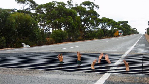
About an hour outside Fowlers Bay we stopped by the side of the highway for no apparent reason. Kylie explained that we had just crossed the Dingo Fence, the longest man-made structure on the planet (yes, longer than the Great Wall of China). The 5,641-kilometer fence keeps the wild dingos (the dogs that are Meryl Streep’s baby) in the western half of the country. It is meant to protect livestock from the canine predators, but the plan has backfired. Without dingos, feral cats and rabbits have become a huge problem. The government is debating whether to cut holes in the fence every few kilometers to reintroduce the dingo into the east and cut down the cat and rabbit population. (For more on how introduced species create havoc in Australia, rent the fantastic documentary “Cane Toads.”)

Where the Dingo Fence crosses the highway there is a metal grate that the dogs will not cross. There is room to crawl under the road and stick your hands through the grate. A few of us did this for a lark while Kylie snapped pictures.


As we were now on the true Nullarbor, services were few and far between. Most of the traffic is road trains, and the businesses on the route all cater to the trucker drivers. Dotted on the landscape are a handful of “roadhouses” offering fuel, food, showers and toilets and sometimes a place to sleep. Prices are steep and we avoided buying supplies if possible. And no, Patrick Swayze was not spotted at any of the roadhouses.

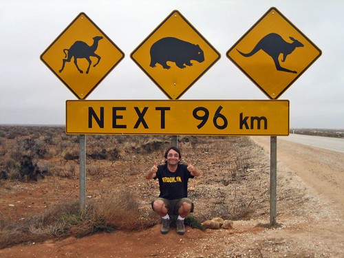
Just past the Nullarbor Roadhouse we stopped for pictures at the famous Camel-Wombat-Kangaroo Crossing sign. There is little to attract the eye on the Nullarbor other than scrub and sky, so road signs became a major attraction. This one tops them all. Unfortunately, we didn’t see any camels, wombats or kangaroos the entire 96 kilometers.


To break up the drive we stopped at the Bunda Cliffs in Nullarbor National Park and walked through the sand dunes at Eucla to visit the ruins of an old telegraph station on the border of South Australia and Western Australia.

The Bunda Cliffs show three layers of geological sediment. The bottom layer of white limestone was formed between 70 and 90 million years ago when the Nullarbor was covered in ocean. The weather was still overcast but the views were still spectacular. The pictures don’t show the extent of the views. I did enjoy a sign warning tourists of the danger of the cliffs – no words, just a picture of a stickman tumbling to his doom.

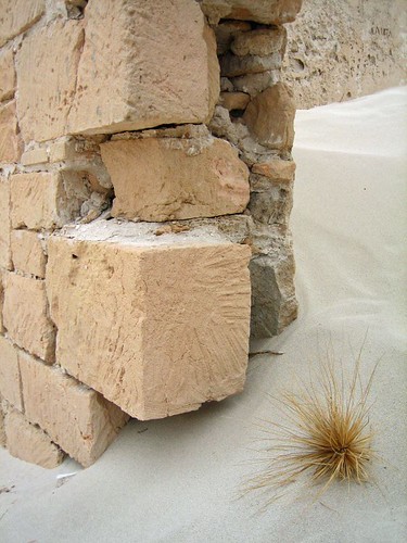
The Eucla Telegraph Station used to convey messages between the states of South Australia and Western Australia. Legend says the telegraph operators in each state hated each other and never spoke, even though they spent all day in adjoining rooms. Their only contact came when exchanging telegraph messages. The station was buried by by the sand dunes for about 80 years, when vegetation kept the sand in place. But rabbits ate all the foliage and the sand shifted again, exposing the ruins below.


Day four ended with a night of true bush camping – no facilities, no neighbors, nothing but our crew and the desert. Kylie taught me how to make damper, Australian bread. You mix flour, self-rising flour and water, throw in a few dried fruits, knead and shape, then sprinkle the top liberally with sugar. Once the campfire embers are nice and hot, you put the loaf into a covered pan and place in the fire. Twenty minutes later, you’ve got yourself a loaf of doughy, sweet bread. Slice and top with yogurt and Bob’s your uncle. (I don’t actually know what “Bob’s your uncle” means, but I like the sound of it.)

DAY 5

Kylie made an executive decision on day five to forego another night of bushcamping in favor of a long day of driving to Lucky Bay at Cape Le Grand National Park, where we would set up for three nights in one location. Along the way we stopped to stretch our legs at a two of the caves on the Nullarbor. As I’ve mentioned, the Nullarbor is composed of limestone, which is prone to erosion, which forms caves.

The Nullarbor Traveller tour used to include an afternoon of swimming in an underground freshwater pool at Cocklebiddy Cave. But a cave-in a few years ago left the cave unstable and the Parks Department closed it to visitors.

There is also an interesting story associated with Cocklebiddy Cave. About ten years ago, a group of scientists set out to map the cave using scuba equipment, spelunking up to four kms under the desert floor. One day an Aboriginal woman, Maureen, appeared out of the bush and told the scientists that Cocklebiddy is a sacred Aboriginal site and that should ask the Rainbow Serpent (a vital player in many Aboriginal creation stories) for permission before entering the cave. The scientists scoffed at the idea and entered the cave. Observers claim a brown snake appeared in the desert and followed the men into the cave.

Soon thereafter, a cloud in the shape of a snake appeared in the sky and let loose with a torrential downpour, dropping 40 milliliters in an hour in a region that gets less than that annually. The cave entrance crumbled, trapping the divers inside for two days. When they were finally rescued, witnesses saw the snake follow the men out of the cave.

I don’t know if I believe this story, but the storm was documented and multiple witnesses claim they saw the snake and Maureen. Was she a ghost? Was the snake the Rainbow Serpent? Nobody knows.

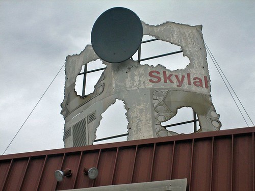
Back into the bus for the long drive to Lucky Bay we cover the 90-Mile Straight, the longest stretch of straight road in Australia, and then stop in Balladonia for fuel and to admire a piece of Skylab mounted on the roof of the roadhouse. I remember hearing about Skylab falling from space in 1979. The news described the area as a remote part of “Outback Australia.” I never intended to visit the area but was pleasantly surprised to pass through. The small museum documenting the event was closed for repairs. I will have to look it up on Wikipedia someday.


We arrived at Lucky Bay as the sun was setting, and after logging 731 kilometers on the day set up camp for the next three nights.

DAY 6

For the first time on this trip, I slept past 8. I woke to kangaroos, a mother and her joey, nibbling their breakfast in the middle of the campground, unconcerned about the humans in their midst.

We piled into the bus for the 50 km drive to the city of Esperance (Population 15,000), the first town of any significance that we’d seen since Port Augusta on day one. After just five days in the bush, I was struck by our return to civilization. I’m a big fan of electricity (and hot showers), a fact I’m sure of after being without for a few days.

We toured the town’s white-sand beaches, rated as the best in Australia, before Kylie let us loose for 90 minutes of lunch and shopping. I ate a huge hamburger, caught up on email and bought an Australian power chord for my laptop.

Back at Lucky Bay, the wind was whipping and the sea too rough for swimming. So we made a mockery of cricket on the beach before a late afternoon bushwalk.

In the late afternoon, we set out for Frenchman Peak, a granite mountain no more than 800 feet tall, but still the highest feature of the landscape. A slow, steep climb brought us to the top of Frenchman, the wind whipping harder and keeping me off balance while enjoying the 360-degree view. Kylie handed out squares of toilet paper and we all let go at once to see whose square would fly the farthest. Mine landed in a bush about ten feet away.


Back in camp, Kylie said it was time to learn about the Tim Tam orgasm. I broke out the bottle of Jack Daniel’s I’d bought in Port Augusta and Kylie brought out the Tim Tams. Tim Tams are made of two rectangular cookies with a cream middle and a chocolate coating. The trick is to nibble off opposite corners, then suck the Jack Daniel’s from a cup into the cookie’s interior. Crunch, smile, yum. You can use milk, tea, coffee, any liquid you want instead of Bourbon. But the combination of Jack Daniel’s and chocolate is hard to beat.


DAY 7


The morning of our second full day at Lucky Bay was spent hiking from Cape Le Grande Beach to Hellfire Bay, a 3-hour trek through coastal scrub, over marbled granite slopes and across a beautiful white sand beach. The swim with the sea lions on day two will forever be the highlight of this tour, but this hike ranks a close second. It felt great to get out and spend quality time tramping through the bush.


After the hike, a swim in the crystal clear water at Lucky Bay and then a BBQ dinner that included kangaroo sausages (‘Roo Bangers). The meat is tasty, not like chicken, but the prospect of kangaroos bouncing through camp while I was chomping on a sausage dampened the experience.

DAY 8

Not every day on a tour can be great, and day 8 sucked.

Here’s the short version: a long day of driving, no hike at Bluff Knoll due to bad weather, the winery shut for the day and the land around the campground decimated by a bushfire the week before.

Still, it was nice to leave the desert behind and enter a landscape with forest and greenery. We also passed through the Fitzgerald Biosphere, an area of 330,000 square kilometers where 75% of the plants and animals do not occur anywhere else in the world. One example is Australia’s most deadly snake, the Dugite. We didn’t see one.
DAY 9

With mixed emotions, I rose for the last day of the tour. It had been a lot of fun, and we’d covered a lot of ground, but I was ready to see a city and check in with the news of the world.

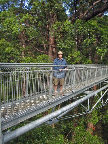
There rain continued as we entered the Valley of the Giants outside of Walpole for a tree-top walk among old-growth Red Tingle eucalypts. A series of suspension bridges form a 600-meter loop through the forest canopy. The steel walkways sway 40 meters above the forest floor, offering spectacular views of the trees and the ground below. As we begin the walk, the clouds part, the sun starts shining and the whole forest glistens.

We stopped for lunch at the Diamond Tree Fire Lookout, a eucalypt more than 50 meters tall with a series of spikes circling the truck to form a ladder and a small cabin perched at the top. A fire ranger would climb the tree in the morning and spend all day scanning the horizon for smoke. A small black PVC pipe carries waste from the top to a chamber on the ground. I climb about 30 feet before freaking out and descending for lunch. Without ropes or a harness, it felt too high, too exposed and too unsafe for a 40-year-old with wonky depth perception.

A few hours later, we pass through Bundury and Kylie points out the first traffic light in 3,900 kilometers. An hour later we are in Perth and the tour is over. We’ve covered the distance from London to Moscow with no injuries, no fights and smiles all around.

When I look back on my nine days crossing the Nullarbor, I recall the swim with sea lions, the desolation of the plain, the road trains, hiking and camping at Lucky Bay. The names of towns run through my mind – Iron Knob, Widunna, Venus Bay, Streaky Bay, Penong, Fowler Bay, Caiguna, Balladonia, Eucla, Madura, Esperance, Jerramungup, Porongurup – places I will probably never see again, but am happy to have seen once. If you are ever in Australia with nine days to kill, travel across the Nullarbor. You won’t regret it.

Flickr Photo Set: Across the Nullarbor (147 Photos)

Labels: , ,

Tuesday, February 20, 2007

Classic Coast: Days 3 and 4

(Note: This is part three of a series. Scroll down if you missed the first two posts.)

The first stop of day three was an hour outside of Port Fairy. A huge crescent of white sand beckoned at the beach at Bridgewater Bay. There was an option to take a boat ride out to Cape Bridgewater to see fur seals, but I chose to enjoy an hour of solitude on the deserted beach. We arrived early enough that the sun had not yet begun to bake the sand and fry our heads, and the hour I spent wandering the beach was one of the most pleasant of the whole trip. I mostly just walked slowly and gazed at the water, but did take some time for some self-portraits. The number of people who passed me during the hour could be counted on one hand. Double the count to include their dogs.


I returned on time to discover there was a delay for the folks on the boats trips, so we were given another hour at the beach. It was spent chatting with Bernie and Kate Barnes, a retired couple from England who I would spend a lot of time on the rest of the tour and in Adelaide. I’m tempted to say they were lovely, or charming, or some such thing, but they were too cool for cliché. We sat outside the beach’s café and did what travelers with time on their hands tend to do: traded stories, remarked on the scenery and discussed destinations on past and future trips. We also found a common interest in travelogues by Bill Bryson and laughed at his description of the giant kitschy statues dotted across Australia.

The last boat finally landed and we were on the road again and crossing into the state of South Australia.

The Australian government is serious about accidents on its highways, and frequent signs remind drivers to pull over and rest. “Drowsy Drivers Die” was one particularly alliterative example. Another reminder was the use of painted metal posts to mark the location of wrecks. Black posts meant a death; red signified an injury. Most of time a single post stood by the road, but some locations might offer four or five red posts and a black one at the end of the row. Once Lawrence clued me into the meaning of these markers, my eyes were peeled for them. (For kangaroos too, but I still haven’t seen a live one yet, only roadkill.)

With the Great Ocean Road behind us, there was more driving and fewer stops. We traveled away from the coast, but often I caught glimpses of the ocean in the distance.

The rest of day three included a trip to the Umpherston Sinkhole (more limestone) and a stop at the Blue Lake, a volcanic crater that is now a reservoir for the city of Mt. Gambier. The blue lake gets its color from, yes, you guessed it, the limestone. Calcite crystals dissolve in the water and turn it a shocking shade of blue. There was mention of phosphorus, but no stink lingered in the air.

The day ended with a short walk along the cliffs of Cape Buffon at Canunda National Park. After the Shipwreck Coast, this walk was less of the same. Still, getting out of the bus and stretching our legs left everyone prepared for a night out in the town of Robe. Our backpackers’ accommodation was a converted 1880’s mansion, complete with library, tv room, volleyball court and a resident puppy more than happy to play tug-o-war with the paying guests.

We had dinner at a local pub, where Lawrence got nipped in the ankle by a small snake while we hung out in a dark corner of the patio. It was enough for him to break a nervous sweat and leave to seek medical attention. With 10 of the 10 most venomous snakes in the world living in Australia, I don’t blame him for being cautious. It turned out to be nothing and he was ready to roll the next morning.

On day four, our last day on the Classic Coast, the heat was dampened by a cloud layer. Lawrence told us the first stop was a visit with his friend Larry, and he made a show of calling “Larry” before we arrived. Bernie, Kate and I knew what was up before the bus arrived at a giant lobster perched in front of a gift shop. Lobster fishing is a multimillion-dollar industry on this part of the South Australia coast, and Larry commemorates this with kitsch. Fifteen minutes with a giant lobster never killed anyone and we all had a good chuckle. Australia also has a giant pineapple, koala and other sculptures. The lobster is enough for me.


Larry stayed behind and we drove to Coorong National Park, a mass of wetlands that is extremely dry due to drought and the diversion of water to local farms. We stopped at 28 Mile Crossing for a walk over the sand dunes to another deserted beach. I could have spent the day there, but a tour is not a tour without a tight itinerary. As much as I enjoyed the trip and saw more than I ever would have seen on my own, it was disappointing to be told to move on after 45 minutes on this beautiful beach.


The Coorong is also home to the Ngarrindjiri Aboriginal people. The Ngarrindjri have bought their land back from the Australian government and are slowly populating the area with native plants and returning it, as much as is possible, to it’s natural state. We were given a tour of the area by a local guide and learned a smidgen about the area’s edible plants and the culture of the Ngarrindjiri nation. I wanted more, but was content with this first taste of Aboriginal life. There will be more as I travel around the country, especially into the center in March.

The afternoon was upon us as we crossed the Murray River on a ferry the size of a tea cracker, then up and down the Adelaide Hills (good wine country) for a stop at a corny Bavarian tourist town called Hahndorf. One overpriced Bavarian beer later, we piled back into the bus for the last time and made the short drive into Adelaide. Goodbyes, quick hugs and a round of see-ya-laters and the trip was over.

I had never taken a tour of this kind before and was anxious before it began. I’ve seen too many tour buses in my travels to be comfortable about being part of the masses. Guides carrying colored flags being followed by lemmings is not my style. We were stuck with a tight schedule, and covered a lot of ground between Melbourne and Adelaide – 750 miles in three and a half days – but the trip felt relaxed, the stretches in the bus were never too long and the group coalesced into a fun little unit. I’m happy I took a chance and hopped on the bus. Will I take another tour with 20 people? Probably not. But hey, who am I not to try something once?

Flickr Photo Set: Classic Coast (73 Photos)

Labels: ,

Classic Coast: Day 2

(Note: this is day two of a four day trip. Scroll down for day one if you missed it).

In the interest of brevity I will not describe every stop along the Great Ocean Road. It’s enough to say that day two provided adventure and a mind-boggling display from Mother Nature. The cliffs of the Victoria coast are composed of limestone, a porous rock susceptible to erosion and change. The result is jagged coastlines, secluded coves and spires that jut out of the sea and appear ready to topple at any moment.


However, before heading to the coast and the helicopter, the first stop of the day was a short walk at Melba Gully in the Otway National Park. To my surprise, right there on the southern coast, right next to the Bass Strait that separates the mainland from Tasmania, is a small rainforest. The walk (to short and easy to qualify as a hike or bushwalk) took me back to my recent trip through Northern California to see the redwoods. Wet conditions, giant ferns and a look at a few Mountain Ashes, the tallest flowering trees in the world. A quick botany lesson and we were back on the road headed for the Shipwreck Coast in Port Campbell National Park.

This treacherous stretch of coastline claimed dozens of ships in the years when traffic was steady between England and the colonies. The most famous landmark is the 12 Apostles, a series of 12 limestone stacks that are best viewed from the air. One of my goals on this trip was to ride in a helicopter – check it off the list.

When I learned that the 10-minute ride over the coast was affordable, at least by my standards, I jumped. The sensation of rising straight from the ground and hovering over the coastline was beyond my expectations. How can you really know what it’s like to hover 1,000 feat above the ocean until you’ve done it? The ride was a quick back and forth over the 12 Apostles and along a stretch of the Shipwreck Coast to a famous site called Lord Ard Gorge. At the center of the picture below, behind the horseshoe shaped island, is the gorge.


It’s impossible to get all 12 apostles into a photo because in July 2005 one of them collapsed, leaving only eight. You can just make out a pile of rubble at the center of this photo.


The apostles will not last forever – they are eroding at a rate of 2 cm per year – but there’s time for all of us to get out there and see them.

The next stop was Loch Ard Gorge, the site of a famous shipwreck in 1787. The site’s fame comes from the fact that two out of 55 passengers on board the clipped the Loch Ard survived after being washed into the gorge. Standing on the beach and gazing at the narrow passage to the ocean, I realized how lucky they were. And later looking at my helicopter photos drove the point home.


The rest of the day was spent hopping in and out of the bus at one scenic vista and photo op after another – London Bridge, The Grotto, and a 280-degree panorama at the Bay of Islands. They begin to blur together after a while, but each one was breathtaking. The only drawback was the scorching heat and the persistent and annoying black flies. There’s a joke that the motion of waving your hand in front of and around your face to shoo away the flies is called the “Australian Wave.” One day on the Shipwreck Coast and every member of our group mastered the technique.

The last stop of the day was at the Tower Hill game reserve for an up close look at some of Australia’s wildlife. I took a 30-minute walk and saw a handful of koalas and a trio of emus. The koalas sit there stoned and you can walk right up next to them. They are slow-moving creatures with brains the size of a walnut, but they have sharp claws and will take your eye out is provoked. Australia – land of deadly creatures.


The end of the second day also marked the official end of the official Great Ocean Road. We spent the night in a hostel in Port Fairy (insert joke here). The hostel in Port Fairy is a converted old farmhouse. The men stayed in the stables, the women in the coachman’s house and our guide Lawrence enjoyed a private room in the hayloft.

Tomorrow: Deserted beaches, sinkholes and a blue lake.

Labels: ,